The GreenWay is designed to be welcoming and accessible for everyone.
From the beginning, it has been planned as a connected shared path with gentle gradients and smooth, consistent surfaces that support people using mobility aids, adapted cycles, prams, and bicycles.
What was abandoned wasteland now provides a 6km viable connection and recreational space which aims to:
- Enhance participation in outdoor recreation and community events for the whole community including people living with disability.
- Improve connections to local amenities and public spaces that are welcoming and inclusive.
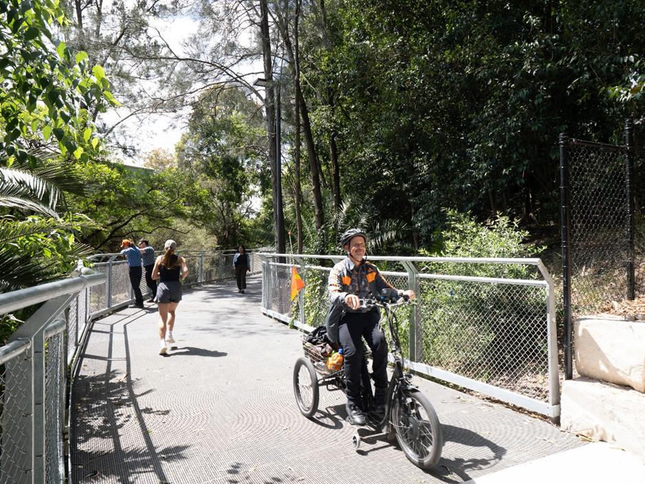
All GreenWay works meet current access standards, considering all needs and ensuring the GreenWay path is as user friendly as possible. Most shared paths along the GreenWay are 3.5m wide. Some short sections are 3m wide due to limited space between the light rail corridor and nearby residential boundaries. The GreenWay also includes some on-street sections, where pedestrians use the footpath and riders use the road.
Shared path etiquette is supported through signage and on path markings that help manage user behaviour.
The pathway is flat along most of the route, with gradients less than 1:20. Three short sections have steeper gradients (around 1:14), where tactile indicators and/or handrails have been installed, these are:
- Approximately 40m on the north side of Longport Street tunnel – required to get from the tunnel level down to existing ground level in Gadigal Reserve.
- Approximately 10m south of Terry Road to avoid existing significant tree roots.
- Approximately 25m on north of the Constitution Road tunnel, adjacent to the play rocket – required to get from existing Arlington light rail station entry footpath to the Constitution Road tunnel level.
All public areas have an accessible option. There are two secondary entry/exit points that are not accessible, these are:
- The stairs at New Canterbury Road
- One stair-only gate at Lewisham West dog off leash area
Note the nearby main entry points are fully accessible.

Photo credit: SKYview Aerial
The GreenWay includes some on street sections and level crossings. Some of these sections have kerb ramps, others are flat. From north to south:
- Marion Street traffic light crossing - curb ramps
- Old Canterbury Road traffic light crossing – curb ramps
- Weston Street on street section – existing footpath
- Hercules Street zebra crossing – flat
- On street sections south of Hercules Street in Dulwich Hill – existing footpath with curb ramps

Photo: Hercules Street zebra crossing
Rest stops and seating areas can be found along the GreenWay. From north to south:
- The Bay Run
- Richard Murden Reserve (900m)
- Gadigal Reserve (500m)
- Lewisham West (Flour Mills) (300m)
- Johnson Park (800m)
- Constitution Road (300m)
- Hercules Parklands (400m)
- Jack Shanahan Reserve (300m)
- Cooks River/Ewen Park (700m)
Seating and tables are provided at rest stops. Seating includes an option with backrests, and an option without backrests, as well as circulation space for wheelchair users.
Some rest stops are in shady locations; others have newly planted trees to provide shade in time.

Photo: Hercules Parklands rest area
Accessible toilets can be found along the GreenWay at:
- the Bay Run at UTS Haberfield Rowers Club
- the inclusive playground at King George Park
Richard Murden Reserve inclusive playground
Lewisham West public toilets on Hudson Street
More public toilets are located in parks and playgrounds along the GreenWay such as: Johnson Park, Hoskins Park and Jack Shannahan Reserve.
GreenWay wayfinding supports most users by:
Consistent placement
Clear fonts
Visual contrast (white letters on a black background)
Limited number of symbols or icons on the GreenWay trail map signs to avoid a cluttered look and keep it clear and coherent.
All artwork signs have a QR code with a link to audio descriptions by Access To Arts: GreenWay Public Art - Inner West Council